


Dicussion of issues concerning existing physical infrastructure. pdf download
Goal: To understand the issues residents have with existing infrastructure in their community.
Audience: A representative sample (groups of no more than 10).
What you need:
– Note paper
– Coloured pens and pencils
– Scissors
– Maps of varying scales
– Cardboard, glue and tape (for model making)
– Flags/ Post-it notes
Description
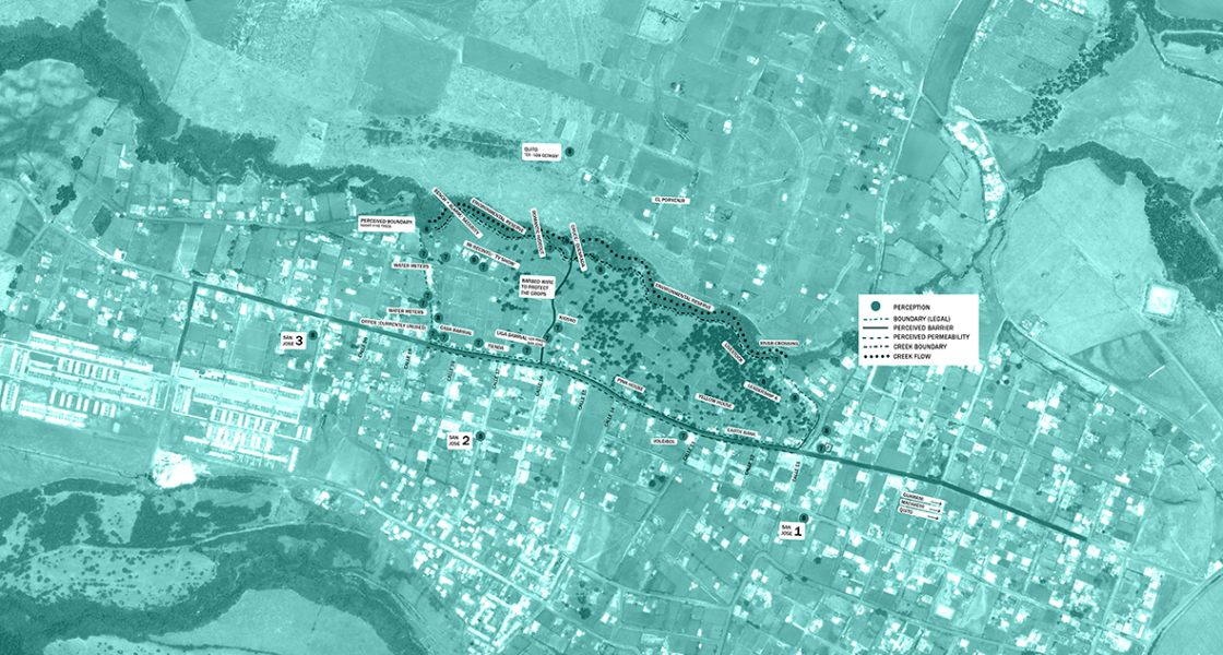
The aim, here is to elicit more specific information from a wide sector of the community and to encourage discussion about the main issues of the neighbourhood and how they could to be solved.
Through a public event held at strategic and very visible spots in a community, 2D maps and/or a 3D model of the neighbourhood can be used in order to facilitate the visualisation of the topic. If discussing social space, you could identify: existing social spaces, where residents would like to have future social spaces and what activities they would like to do this, and areas that residents think might be good for living e.g. cultivation. Mapping could also be used to identify transport infrastructure, schools or religious buildings.
Instructions:
Step 1: Identify topics of conversation and assign colours or symbols to each (to be readable on the model/map).
Step 2: Create a 3D model/2d map with detail to contours, buildings and access.
Step 3: As part of a group discussion (no more than 10 persons) identify the issues associated with each topic and label respectively (flags, Post-it notes etc.).
Step 4: Direct conversation towards resolving the issues with relevant notes.