


Mapping tool to capture available local resources. pdf download
Goal: To identify the location of available resources.
Audience: Local manufacturers, organisations with waste streams, skilled workman, local construction materials stores.
What you need:
– Map of the local area
– Information gathered about resources
– Camera
– Notebook
Description
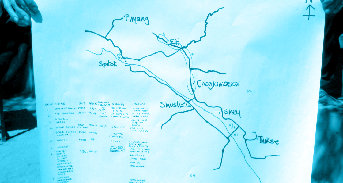
A ‘Harvest Map’ (a term coined by Superuse Studio) is an ethical enterprise method of achieving sustainable construction. By mapping and researching the area surrounding a proposed building site or development, a harvest map can identify potential material resources, skills and knowledge that can be used to inform how a building project is designed and constructed. It has the potential to be a catalyst upon which future building projects or social enterprises emerge. This is a key tool for identifying and utilising local resources to achieve strategic sustainable construction in any context.
Instructions:
Step 1: Locate area of interest and devise research boundaries
Step 2: Carry out resarch via: internet, telephone enquiries, documentation walks (latter stage)
Step 3: Hold meeting to collate information
Step 4: Visit suppliers and skilled craftspeople to establish materials and local skills and knowledge (essential information for materials: material type, size, monthly quantity, source, location, availability, price)
Step 5: Collate information into a detailed resource database with identification map